The best 3D drone mapping softwareProfessional photogrammetry!
Turn any video into 3D models with simple mapping software — no coding needed.
- Quick results
- No credit card required
- Cancel anytime
SkyeBrowse users save up to 90% of their time on data processing
Faster results, unmatched accuracy, and affordable solutions

DFW Airport Police
80%
Faster data processing with precise measurements. Plus, top-notch support!

Utah State Fire Marshal
2x
easier and faster than Pix4D — perfect for quick results!

Middletown Police Department
$4.7M
Saved by modernizing crash scene documentation
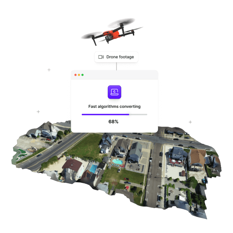
Turn any video into 3D Models in minutes
Simple and intuitive processNo coding or complex software neededInstant 3D model creation from drone footage
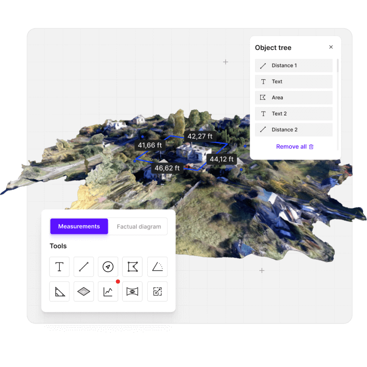
- Quickly analyze crime scenes or accidents to gather 3D data for investigations.
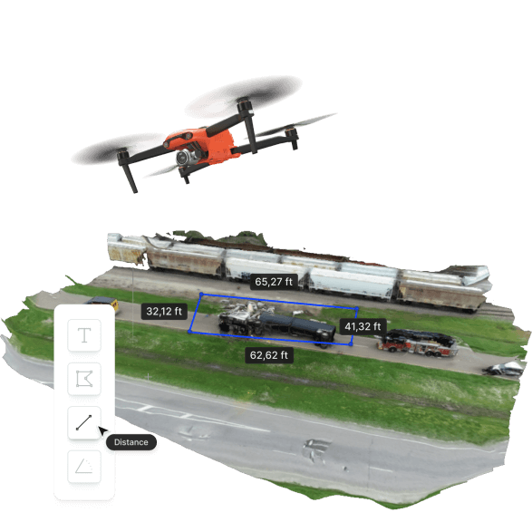
Accurate 3D mapping for large areas
Capture vast areas with a few drone flightsGenerate precise, scalable 3D models of large environmentsReduce time spent on field surveys
- Ideal for surveying construction sites, agriculture, and infrastructure projects.
- Streamline mapping of large geographical areas with high accuracy.
Instant roof inspections & measurements
Quickly capture detailed roof data with drone footageGenerate accurate roof models and measurements within minutesEliminate the need for ladders, scaffolding, or manual measurements
- Inspect roofs for damage, wear, or insurance claims without risk or delay.
Trusted by agencies that keep our country safe


Transforming Emergency Response with Real-Time 3D Modeling
Unmatched situational awareness for responders
Average capture time
Average processing time
Models created from Fatality accidents, crime scenes, and natural disasters mapped.
Active Users
Departments trust SkyeBrowse
Models have gone through court

Emergency response made
faster, safer, and smarter.
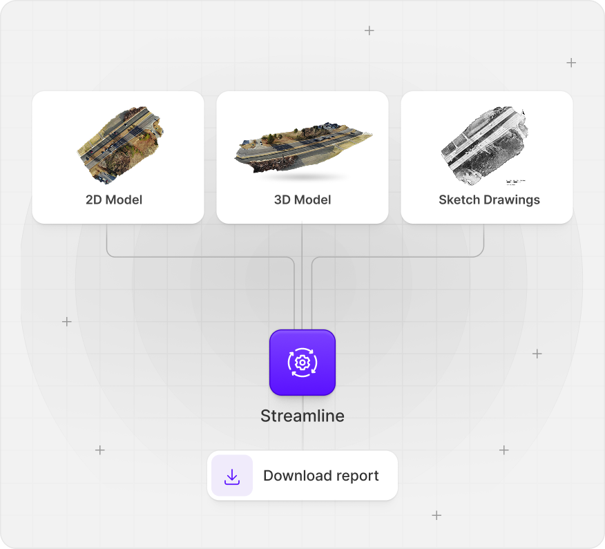
Multiple products for your needs, including 2D/3D Modeling, Sketch Drawings, Interior Maps, Thermal Maps, Night Ops AI, and more.

Make 3D models in
3 easy steps.
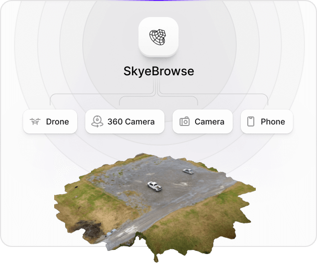
1. Record a video using any device (phone, drone, 360 camera).
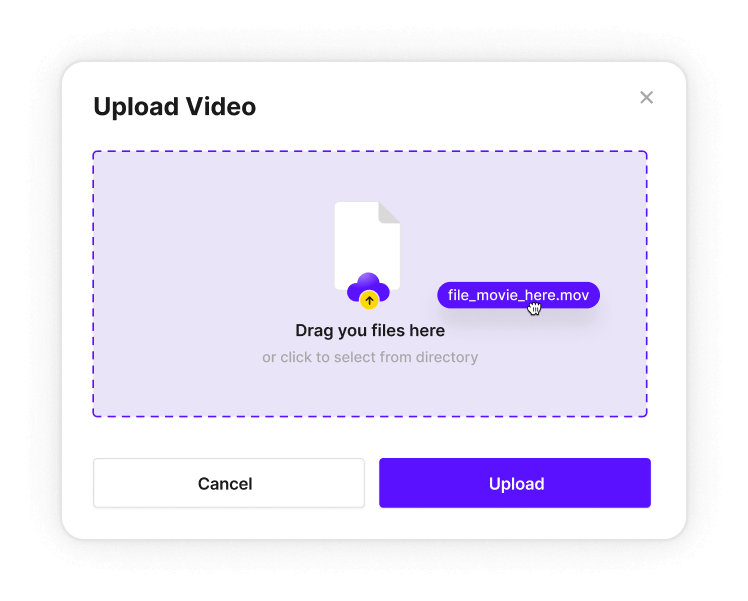
2. Upload your video to map.skyebrowse.com
3. Generate a 2D map, 3D model, and sketch drawing in minutes.
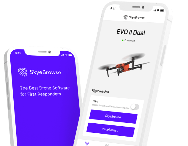
The Best Drone Software for First Responders.
Our cutting-edge software solutions
Universal Upload
Create 2D maps and 3D models
Blazing-Fast 3D Modeling
Get your first 3D model in 2 minutes


Read real reviews from our satisfied customers
I was very impressed by the ease of use. Great measurement accuracy and excellent customer service.
DFW Airport Police
So far it's really easy to use and much more user friendly than Pix4D
Oceanside Fire Department
This is a game changer. I wish this was developed 3 to 4 years ago.
Los Angeles District Attourney's Office
Our Partners
Our partners build technology and software that help work more effectively.


Get started now
Sign up to make 3D models for free
- Quick results
- No credit card required
- Cancel anytime