Map Without Limits:
SkyeBrowse's Large Area 3D Solution
Experience the future of large area mapping. SkyeBrowse harnesses the power of drones and cloud computing to deliver swift, accurate 3D models of vast territories. Capture, process, and analyze extensive landscapes faster than ever before, revolutionizing your spatial data workflow.
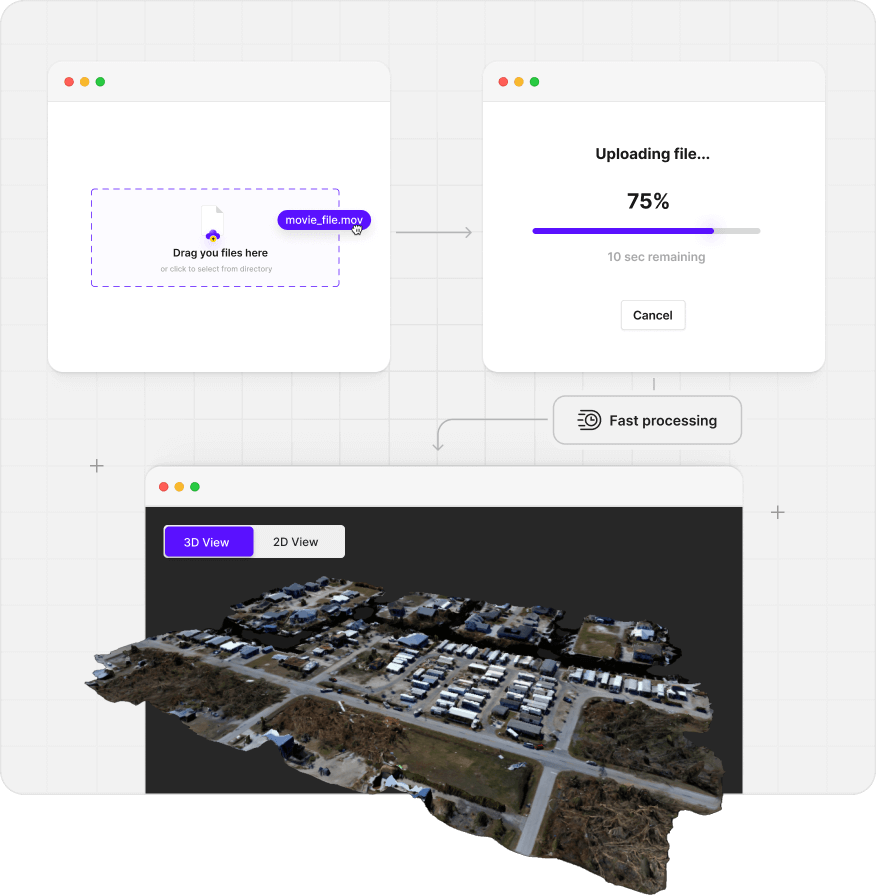
3D models in minutes, not hours
Generate comprehensive 3D models of extensive areas in a fraction of the time traditional methods require. Navigate our intuitive platform with ease, from flight planning to final 3D model. Without the need for specialized training or equipment.
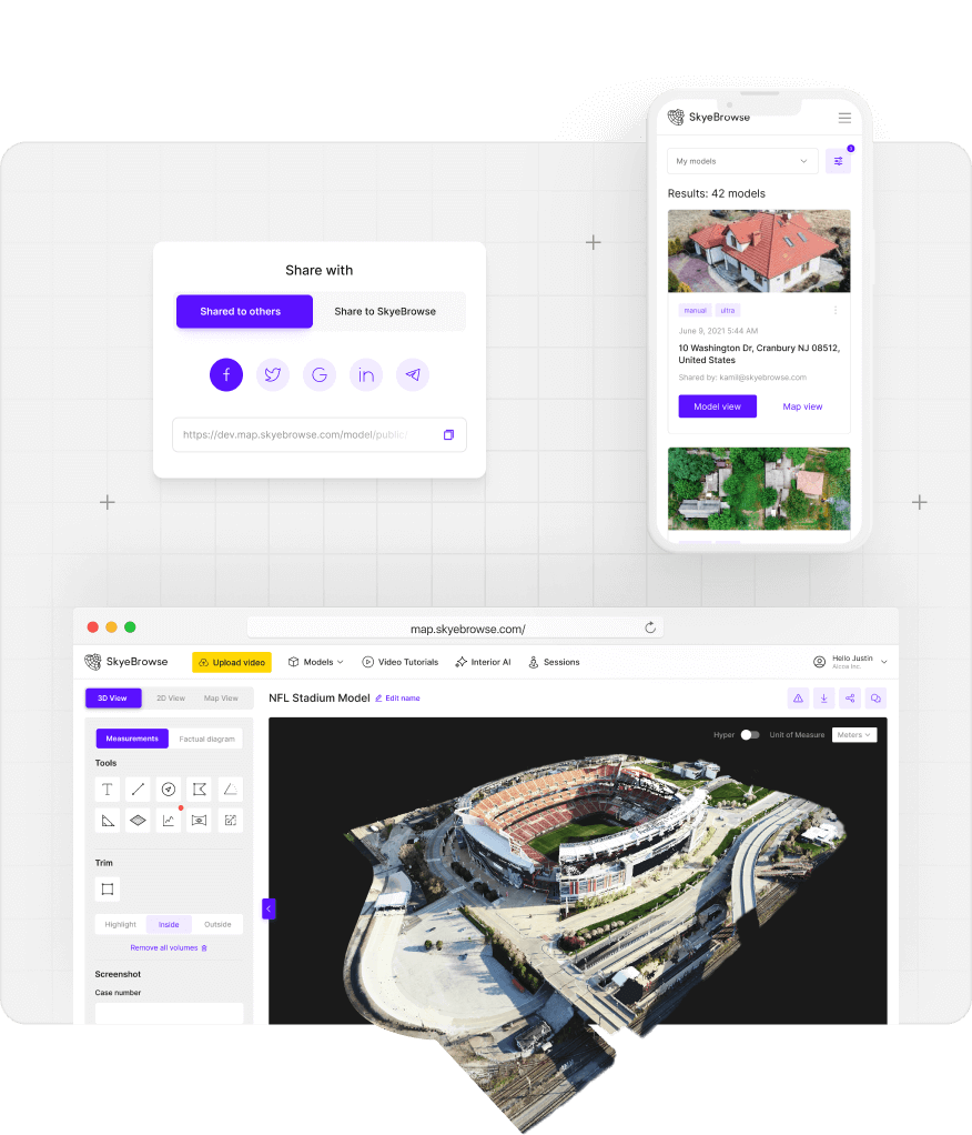
Your models available
everywhere anytime
Access your 3D models anytime, anywhere with SkyeBrowse's cloud-based platform. Our web browser interface allows you to view, manipulate, and analyze your models without the need for specialized software or high-powered hardware. You can share your models with clients, colleagues, and stakeholders with a simple URL
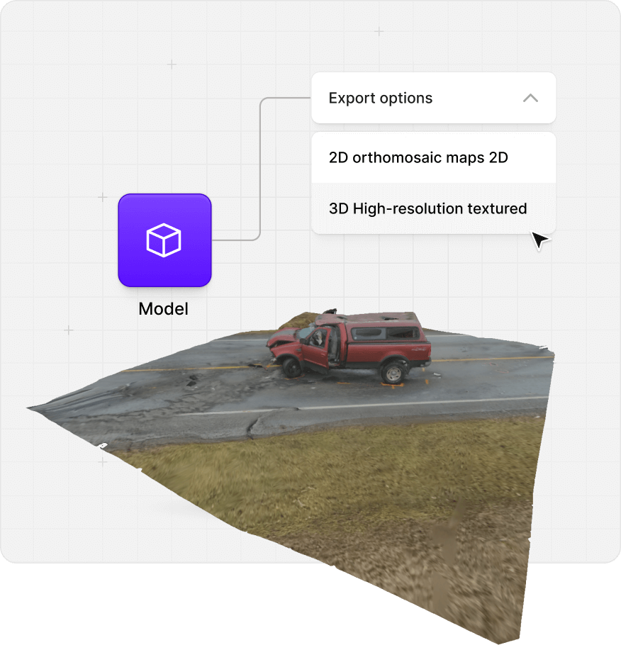
Versatile exports of your data
Need to integrate your data into other systems or workflows? SkyeBrowse offers flexible export options to suit your needs. Download your models as high-resolution textured 3D meshes for immersive visualizations, dense point clouds for detailed analysis, or 2D orthomosaic maps for traditional GIS applications.
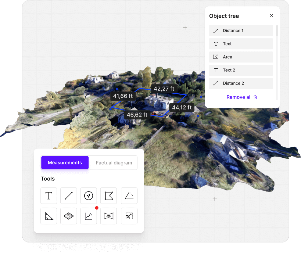
Measure Smarter, Not Harder
Precision Tools for Flawless Accuracy
Equip yourself with a wide array of measurement tools designed for accuracy and ease of use. SkyeBrowse provides the instruments you need for thorough inspections. Measure heights, areas, and slopes with centimeter accuracy. Our intuitive interface ensures that even complex measurements are just a few clicks away, allowing you to gather critical data quickly and confidently.
Elevate Your Investigations with 3D Precision
Transform your investigative capabilities with our drone-powered 3D modeling software. Whether you're a small or a large agency, our flexible plans ensure you have the tools to create compelling, data-rich reports. No credit card required to explore our platform.
Read real reviews from our satisfied customers
I was very impressed by the ease of use. Great measurement accuracy and excellent customer service.
DFW Airport Police
So far it's really easy to use and much more user friendly than Pix4D
Oceanside Fire Department
This is a game changer. I wish this was developed 3 to 4 years ago.
Los Angeles District Attourney's Office