Elevate Your Inspections:
3D Precision at Your Fingertips
Transform your inspection process with SkyeBrowse's cutting-edge 3D modeling technology. From rapid data capture to comprehensive analysis. Our solution empowers you to conduct thorough inspections with unprecedented ease and accuracy. Experience the future of inspections – where speed meets precision, and insights are just a click away.
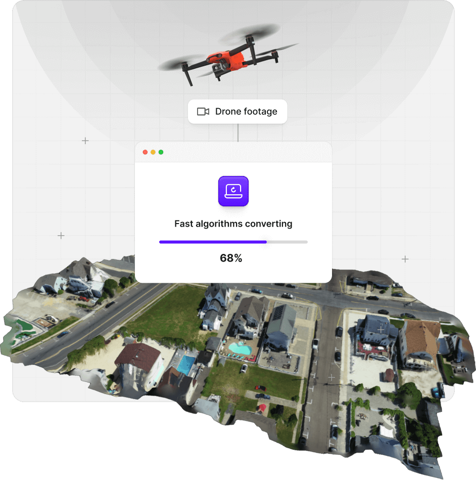
From Drone to 3D:
Lightning-Fast Model Generation
Say goodbye to time-consuming traditional inspections. SkyeBrowse's advanced algorithms convert drone footage into detailed 3D models in minutes, not hours. Capture easily an entire site in a single flight and have a comprehensive 3D model ready for measurements. With our rapid 3D modeling, you'll dramatically reduce on-site time while increasing the thoroughness of your inspections.
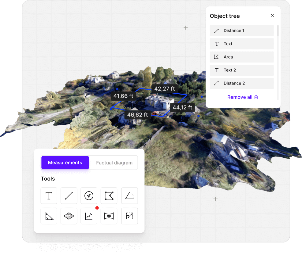
Measure Smarter, Not Harder
Precision Tools for Flawless Accuracy
Equip yourself with a wide array of measurement tools designed for accuracy and ease of use. SkyeBrowse provides the instruments you need for thorough inspections. Measure heights, areas, and slopes with centimeter accuracy. Our intuitive interface ensures that even complex measurements are just a few clicks away, allowing you to gather critical data quickly and confidently.
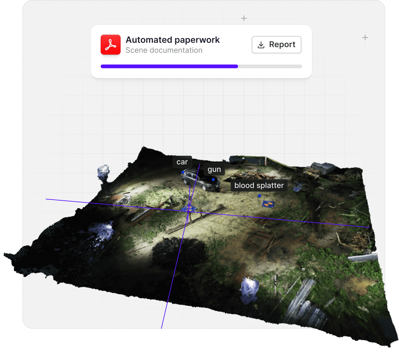
Rapid Scene Documentation
SkyeBrowse transforms the process of scene documentation by enabling models for inspections in a fraction of the time traditionally required. Unlike conventional methods that can take hours to manually measure, photograph, and reconstruct a scene, SkyeBrowse leverages advanced drone technology and proprietary algorithms to capture and process data within minutes tasks.
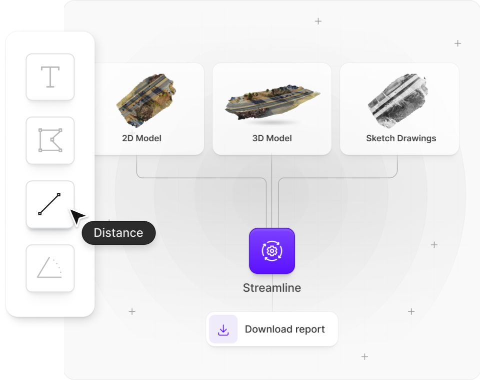
Capture, Convert, Complete:
Streamlined Reports
with 3D Technology
Transform your paperwork process with 3D Insight‘s advanced modeling capabilities. Our solution dramatically reduces the time and effort required for creating detailed reports and documentation. By automatically generating accurate 3D models, 2D maps, and sketch drawings, you can eliminate manual drafting and guesswork.
Elevate Your Investigations with 3D Precision
Transform your investigative capabilities with our drone-powered 3D modeling software. Whether you're a small or a large agency, our flexible plans ensure you have the tools to create compelling, data-rich reports. No credit card required to explore our platform.
Read real reviews from our satisfied customers
I was very impressed by the ease of use. Great measurement accuracy and excellent customer service.
DFW Airport Police
So far it's really easy to use and much more user friendly than Pix4D
Oceanside Fire Department
This is a game changer. I wish this was developed 3 to 4 years ago.
Los Angeles District Attourney's Office