Case Study: Hurricane Helene
The volume tool finds a new use case
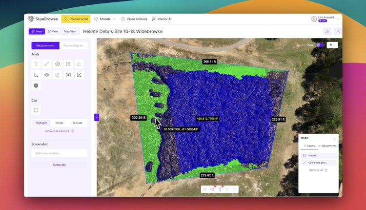
Hi SkyeBrowsers!
Here's an interesting history lesson on our volume tool. SkyeBrowse started in 2020 based on the premise that accident investigation is inefficient. We wanted to build the best solution to map out accidents. While our tech was rudimentary at first, we differentiated ourselves by listening to feedback and providing the best customer service humanly possible. We still stand by those initial premises, although our tech is significantly better now.
We were working on a volume tool back in February 2020, but realized that no one really cared about the volume of a car crash. As a result, after a month of working on it, we moved that feature into the back burner.
Here's an image of what our tool looked like in 2020. What a throwback to the past!
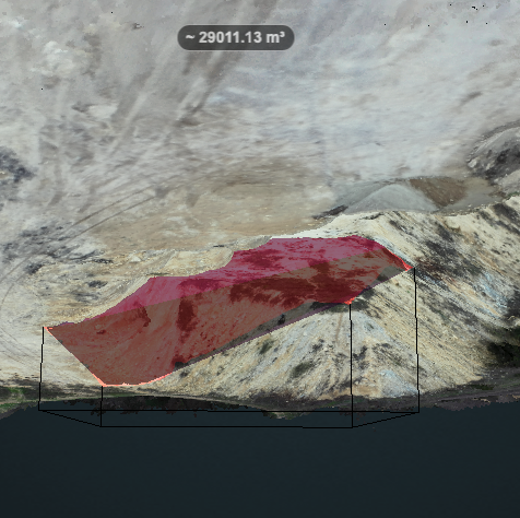
However, as more of our 50,000 end users started asking about volumetric measurements, we built it out in the easiest way possible. We tested out the volume tools of our competitors and realized it was slow and too hard to use. So we built a tool that was quick and easy to use, and we released it for stockpile measurements.
When dozens of agencies reached out for SkyeBrowse licenses during the hurricanes, we expected them to rapidly map out areas for disaster declarations and FEMA reimbursements. However, I had no idea that our volume tool could be used for more than just construction.
New Volume Case Study — Hurricane Helene
In the aftermath of Hurricane Helene, emergency response teams faced a critical challenge: accurately measuring and tracking debris removal progress across multiple sites. Here's how our new Volume Tool transformed this process:
🔍 The Challenge
- 13,000 acres of affected area needed assessment
- Multiple debris collection sites required ongoing monitoring
- FEMA needed accurate documentation for reimbursement
- Traditional measurement methods would take days per site.
💡 The Solution
Working with the City of Aiken, SC, we implemented our new Volume Tool to:
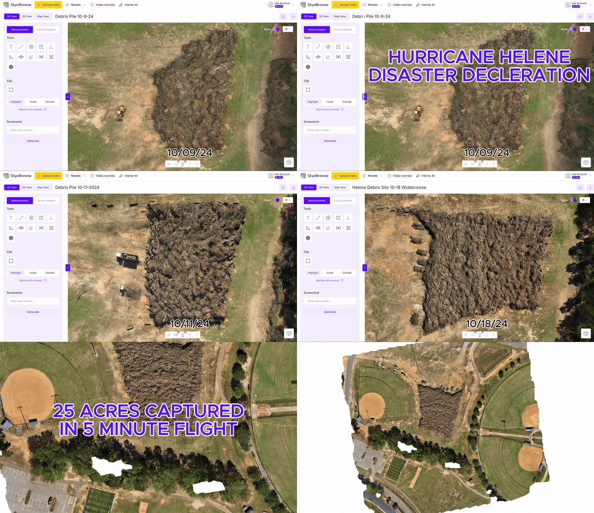
- Create 3D models of debris sites in under 5 minutes per location
- Track volume changes over a 2-week period
- Generate automatic calculations for debris removal progress
📈 The Results
- 90% reduction in measurement time
- Sub-cubic-yard accuracy for FEMA documentation
- Real-time progress tracking across all sites
- Eliminated need for manual surveys and calculations
💰 Cost Savings
- Saved approximately 160 labor hours in manual measurements
- Reduced survey equipment rental costs to 0
- Accelerated FEMA reimbursement process
🚀 Key Benefits
- Instant volume calculations
- Historical tracking capabilities
- Shareable 3D models for all stakeholders
- Documentation for federal disaster relief funding
I'm proud to see our technology making a real difference in disaster response efforts.
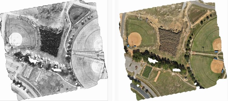 Sketch Drawing and 2D Map of Debris Pile
Multi-Agency Training
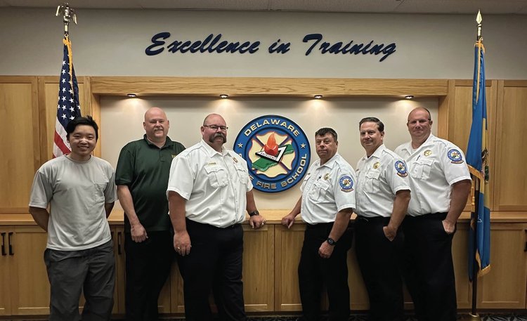
We're conducting multiple 2 day trainings in the Dallas-Fort Worth, Los Angeles, and Salt Lake City metroplex areas. This is a 2 day multi-agency course, split between a classroom day and practical day. The practical day would mock up scenarios for WideBrowse pre-plans and CBRNE thermal mapping live incident response. The purpose of the training is to reinforce the following steps with SkyeBrowse:
- Rapid initial assessment with thermal/day/night mapping
- Assistance in establishing ICS structure
- Enhanced situational awareness for incident commanders with 2D mapping
If you are an agency interested in learning more, reach out to us to schedule a training session. We promise it won't be death by powerpoint!
